Home
West Bank
Closure Maps
Thematic Maps
Gaza
Closure Maps
Thematic Maps
Annexes
Palestinian communities
Israeli settlements & checkpoints
Digital services
Printable PDF
Digital Services
Back
Printable PDF of this section
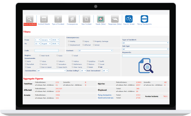
Data on casualties
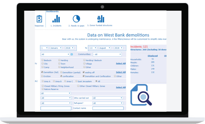
Data on demolition and displacement in the West Bank
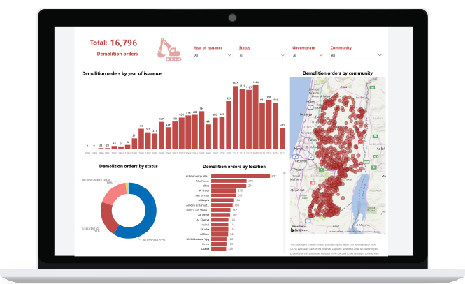
Demolition Orders against Palestinian Structures in Area C – Israeli Civil Administration data
HRP Data: interactive charts
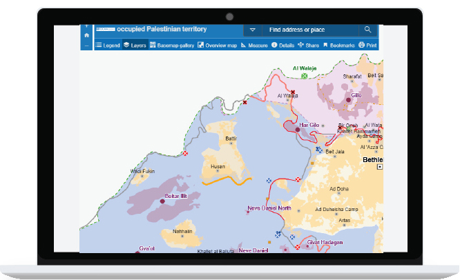
The interactive map of the occupied Palestinian territory
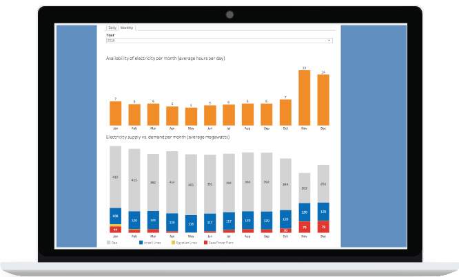
Gaza strip electricity supply
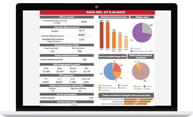
2015 Gaza survey of internally displaced persons
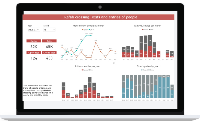
Gaza crossings: movement of people and goods
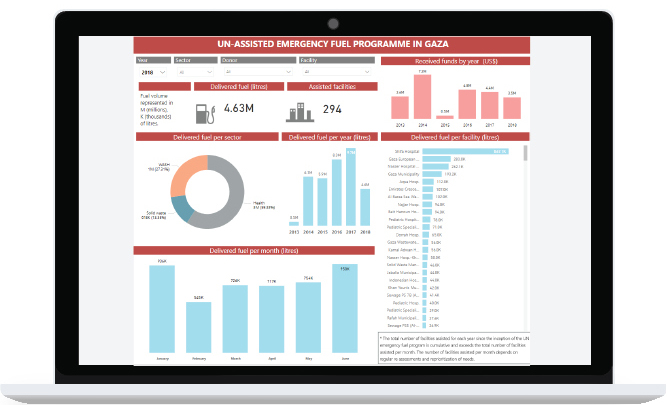
Interactive charts on emergency fuel
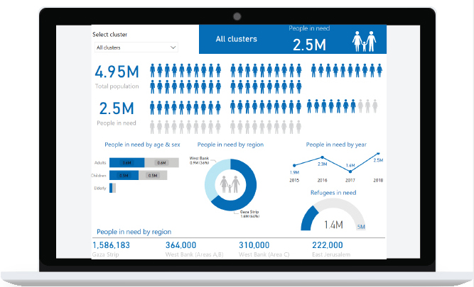
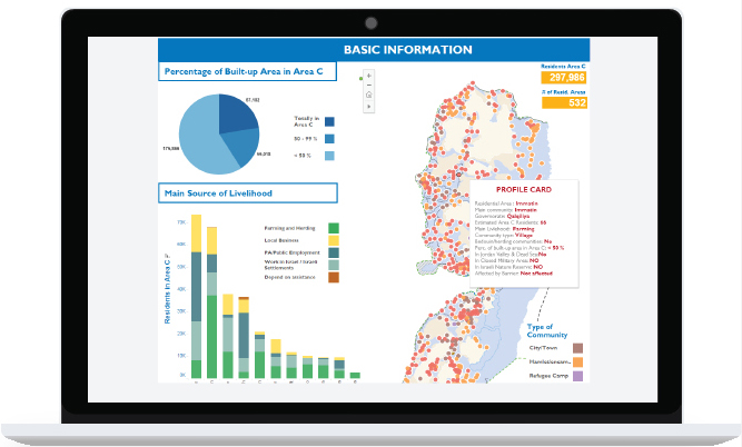
Vulnerability Profile of Palestinian Communities in Area C
2015: Interactive, community-level infographics on humanitarian vulnerability
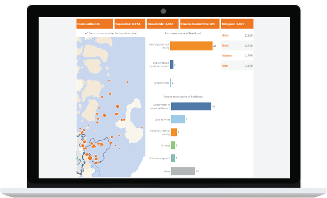
46 Bedouin Communities at Risk of Forcible Transfer in the Central West Bank: A Vulnerability Profile
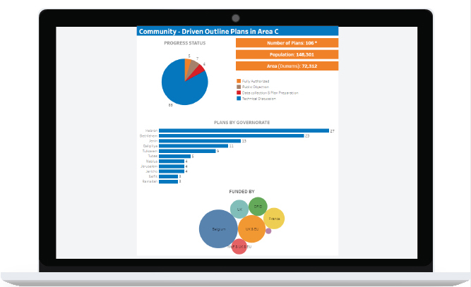
Community - Driven Outline Plans in Area C
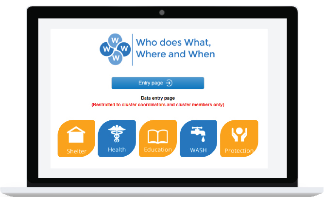
Who does What Where and When (4W)
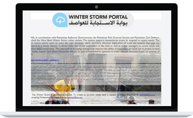
Winter storm portal
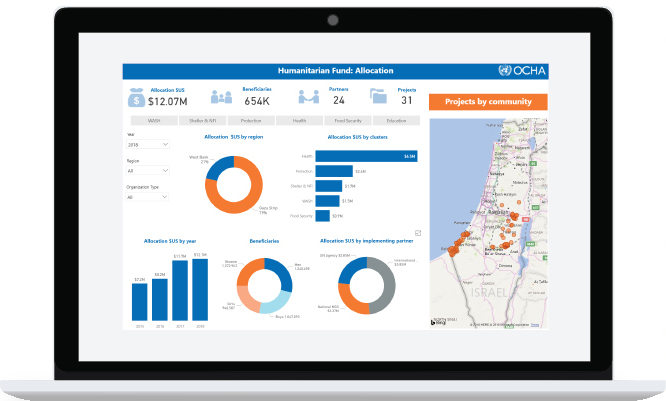
oPt Humanitarian fund