Most Palestinian plans to build in Area C not approved
The Israeli authorities approve only five of over 100 outline plans submitted by Palestinians in Area C
Contributed by UN-Habitat - Special Human Settlements Programme for the Palestinian People
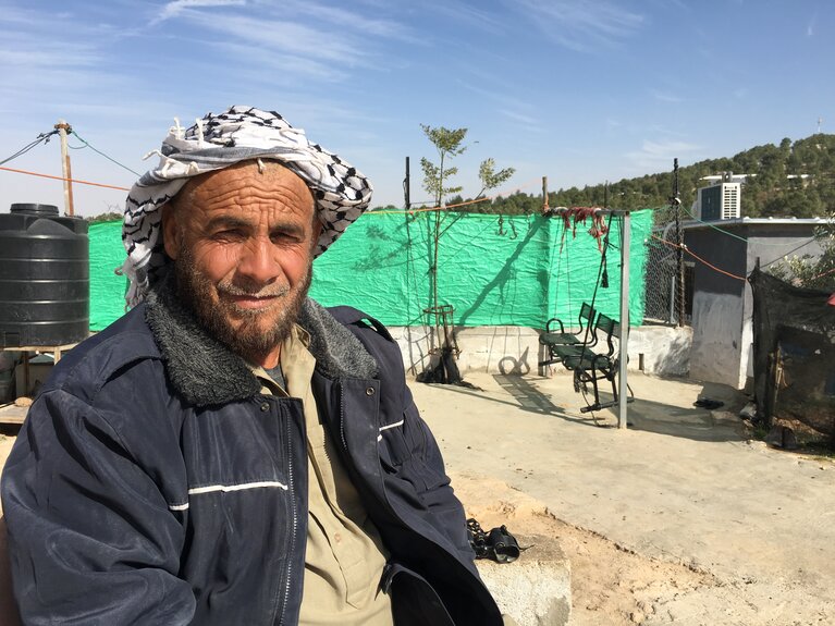
“My son has a house that is located within the boundary of the local outline plan in our village, whereas my house is located outside the planned area. At night, I can’t sleep out of fear of the soldiers arriving at any moment to demolish my house. When all the worrying gets too much for me and I want to get some sleep, I go to my son’s house. The risk of my house being demolished is still there, but I know that his house is safe and secure, and that makes me feel better. Next to us, the settlers are expanding their settlement. We can hear a bulldozer working, but we can’t do the same here.”
Fadel, 55, Palestinian father of 11 children, At Tuwani village (Hebron).
What do you do if you are told you need a permit in order to build a home that would not be demolished, but it is all but impossible to acquire such a permit? This is the situation facing many Palestinians living in Area C in the West Bank.
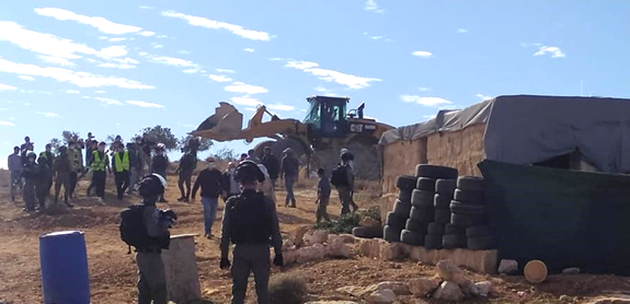
According to the Israeli authorities, the extensive demolition of Palestinian homes and other structures in Area C is due to the structures being erected without Israeli-issued building permits. Between 1988 and 2014, the Israeli Civil Administration (ICA) issued over 14,000 demolition orders against Palestinian-owned structures located in Area C on these grounds.[1] In 2020, a total of 668 structures were demolished in Area C, the highest annual number recorded with the exception of 2016, since OCHA began systematically documenting this practice in 2009. In 2021, the trend is seemingly continuing, with a total of 259 Palestinian-owned structures demolished or seized in Area C (as of 31 March), an increase of 216 per cent compared with the equivalent period in 2020.
The vast majority of Palestinian applications for Israeli building permits in Area C are rejected by the Israeli authorities on the grounds that the relevant area has not been zoned for construction. This is the case even when the land for which the permit is requested is undisputedly owned by the Palestinian applicant. Consequently, it is virtually impossible for Palestinians to obtain building permits: according to data obtained by the Israeli organization Peace Now from the ICA, between 2009 and 2018 only two per cent of all requests submitted by Palestinians for building permits in Area C were granted (98 out of 4,422).
A restrictive and discriminatory planning regime
Following its occupation of the West Bank in 1967, the Israeli authorities took over the planning powers endowed by the Jordanian Planning Law, which was in force at that time. This law was subsequently amended by military orders, which annulled the local and district planning committees representing the Palestinian population, and transferred their powers to the Higher Planning Council, which is exclusively staffed by Israeli officers.[2]
During the early 1990s, the ICA approved some 400 ‘partial special outline plans’ for localities across the West Bank, which were produced with little or no consultation with the Palestinian population. Of these plans, around 110 cover areas that later became Area C and have remained in force through to the present. While structures located within the boundaries of these plans are protected from demolition, less than one per cent of Area C is covered by a planning scheme for Palestinian communities approved by the ICA. Additionally, these plans only covered part of the built-up areas of communities in Area C, leaving little opportunity for community development, and placing the structures outside the planned areas at risk of demolition.
By contrast, local outline plans[3] approved by the Israeli authorities for Israeli settlements cover at least 8.5 per cent of Area C, according to 2015 OCHA’s estimates. Settlements are illegal under international humanitarian law as they violate Article 49 of the Fourth Geneva Convention, which prohibits the transfer of the occupying power’s civilian population into occupied territory.[4] According to Peace Now, in 2019 and 2020, the Israeli authorities approved plans for 16,098 units in settlements and issued permits for at least 2,233 housing units.
All local outline plans in Area C are considered amendments of the Regional Outline Plans, approved in the 1940s by the British Mandate. These regional plans designated most of what subsequently became Area C as an ‘agricultural zone’. Although, in theory, they do permit limited construction for residential and other purposes for Palestinians in an agricultural zone, the ICA regularly rejects most building permit applications by Palestinians on the grounds that they do not meet the conditions specified in these plans.[5]
Since 2011, Palestinian communities in Area C have been drafting their own detailed local outline plans, as a means of building essential infrastructure and new houses in the framework of a community development officially approved by the ICA. The process has been supported by the Palestinian Authority’s (PA) Ministry of Local Government (MoLG) and international donors and involved significant consultation with the residents of each community. So far, 123 local outline plans have been produced, of which 109 have been submitted to the ICA for approval. Despite the high technical standards of these plans,[6] only five have been approved and another seven have reached the final stage prior to final approval. The remaining 97 plans have been under “technical discussions” for periods ranging from 18 months to seven years, except for four plans submitted in December 2019 and February 2021. The last local outline plans to be fully approved was in 2017.[7]
Except for the period between May 2020 and January 2021[8] when coordination between the parties was halted, the MoLG has engaged with the ICA on behalf of the communities to advance the approval of the plans. This, despite the fact that the PA does not consider full approval by the Israeli authorities necessary in order to advance development and construction in accordance with the plans. Based on certain criteria, the European Union (EU) collectively, as well as certain individual EU members states, sometimes support the construction of essential infrastructure projects in areas covered by pending local outline plans, despite the risk of demolition and confiscation.
The case of At Tuwani village
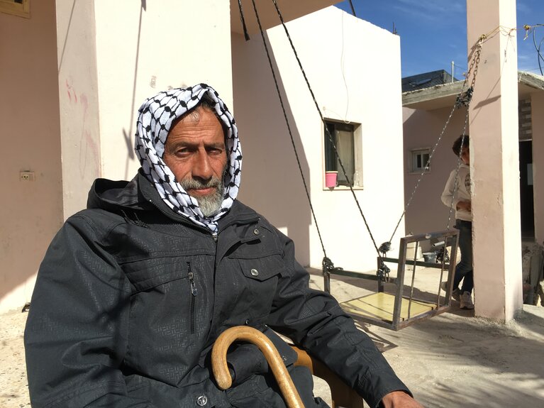
“At Tuwani is located in Area C. Decades ago, 100 people lived in At Tuwani, but we need new structures as our families grow. There is no public transportation to the communities near At Tuwani, and the roads are rough. The settlers fly their drones and film us, they give the orders and encourage the army to demolish our houses. We build on our own private lands, for which we have all the needed documents. But if we apply for building permits, we never get them, so we build anyway. At the same time, Israeli settlers are building on Palestinian lands, against international law, and nothing happens to them.” Musa, father of 11 children, At Tuwani resident.
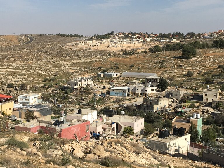
Located approximately one kilometre from the Byzantine archaeological site called “Khirbet At Tuwani”, the small Palestinian village At Tuwani is situated in the hilly southern Hebron governorate. The community consists of about 200 residents who moved from two nearby towns, Yatta and Dura. In 1982, the Israeli settlement of Ma’on was established about 900 metres to the east of At Tuwani.
So far, the ICA has issued at least 40 demolition and confiscation orders against about 48 Palestinian structures in At Tuwani. As of March 2021, four structures have been demolished and 21 residents displaced. In the absence of an approved local outline plan, most of the village’s structures remain under threat of demolition and there is still no legal avenue to transform the village into a liveable habitat with basic services.
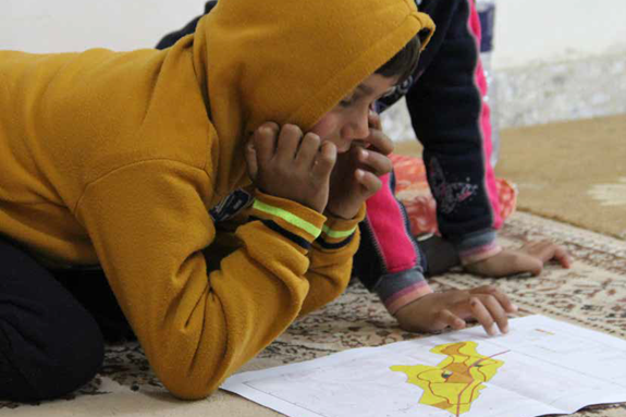
In 2008, ICA commissioned a local outline plan for At Tuwani (no. 1764), mainly covering the already built-up area of the village. This left no room for further development, entailed minimal public participation, and suggestions and requests for change were not accepted. In 2011, the local community took the initiative to prepare its own village plan, with the endorsement of the Palestinian MoLG, technical support from UN-Habitat, and financial support by the United Kingdom, and subsequently by the EU. The proposed plan was submitted to the ICA in July 2011, published for public objection in January 2014, and initially approved on 7 December 2020. The plan is currently awaiting final publication to enter into force.
Bakker is 21 years old and lives in At Tuwani, in the area included within the community-proposed local outline plan: “In the past, we used to stay awake all night, worrying that the soldiers could come at any time to demolish another house. Now we feel a bit more secure, although we are still waiting for the final approval of our plan. I feel assured that if I want to expand my house, my efforts and the money I put into it won’t be in vain. It’s so unjust when you work so hard and invest so much in a house, and it’s all gone in a matter of seconds.”
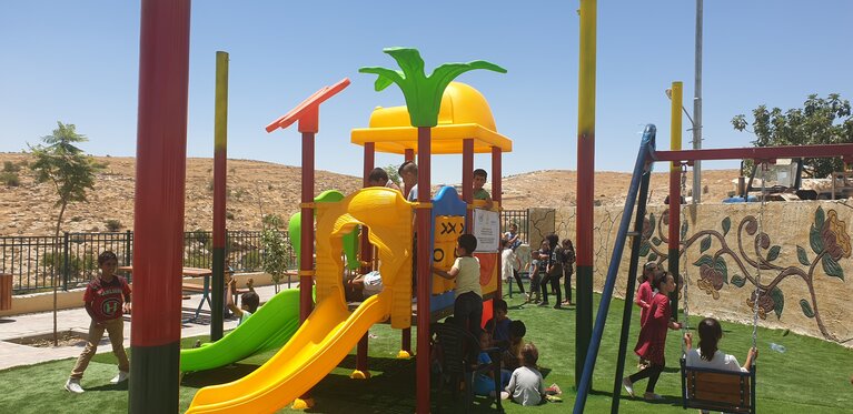
The proposed plan retroactively legalizes structures targeted by 17 demolition orders issued by the ICA. Based on this plan, the EU has supported the construction of an additional floor for the local school, and the rehabilitation of internal roads through the Municipal Development and Lending Fund, a semi-governmental Palestinian institution for reform and development assistance to local government. In addition, UN-Habitat supported the design and implementation of a public space in At Tuwani, with the active participation of women and children’s groups, and with financial support from the UN.
The way forward
The restrictive and discriminatory planning regime applied in Area C and East Jerusalem makes it virtually impossible for Palestinians to obtain the requisite Israeli building permits. Public and confiscated land in those areas has been allocated almost exclusively to Israeli settlements or to the military. Most private land has been zoned as agricultural or ‘green’, or is not planned, impeding the issuance of permits in these areas. To meet their housing and livelihood needs, many Palestinians are left with little choice than to build without permits, risking demolition and displacement, or to move elsewhere. Along with other constraints, the restrictive planning regime applied by Israel in Area C contributes to the creation of a coercive environment on residents, leading to risk of forcible transfer. In addition to demolition and the threat of demolition of homes, schools and livelihoods, other pressures include the denial of service infrastructure; access restrictions on farming and grazing land; poor law enforcement on violent settlers; and the revocation of residency rights, among other policies and practices.[9]
Under international law, Israel has the obligation to ensure that the humanitarian needs of Palestinians living under occupation are met and that they are able to lead life normally. Israel must also ensure that Palestinians under occupation are able to exercise their human rights, including their right to an adequate standard of living, to adequate housing, and to be free from discrimination. International law also prohibits the destruction of private or public property, unless absolutely required by military operations, as well as the forced transfer or displacement of civilians.
The provision of adequate spatial planning for rural communities in Area C is essential to improve the living conditions of their residents and to relieve the pressure on them to move. The use of community-led local outline plans, notwithstanding the time and efforts required for their development and their current rate of approval by Israeli authorities, can potentially remove the risk of demolition. The Israeli authorities’ approval of pending community-led local outline plans for Palestinian communities in Area C would be a significant step towards the fulfilment of their international obligations.
The international community should continue to support spatial planning in Area C and continue its advocacy efforts to defend housing, land, and property rights for Palestinian communities across the oPt, including in Area C.
[1] OCHA, Under Threat: Demolition orders in Area C of the West Bank (2015). In many cases, the same order targets multiple structures owned by the same household (e.g. their residence, an animal shelter, a storage room or a latrine). The actual number of structures affected is estimated, based on an examination of over 90 per cent of the records, to be about 17,000.
[2] For a detailed explanation of the planning approval process for Palestinians in Area C and how it was developed, see Bimkom, The Prohibited Zone. Israeli Planning Policy in the Palestinian Villages in Area C (2008).
[3] Local outline plans are also known as master plans, a statutory planning tool in use in Area C.
[4] This has been confirmed by the International Court of Justice, the High Contracting Parties to the Fourth Geneva Convention and the United Nations Security Council in successive resolutions.
[5] For further details, see: Bimkom, The Prohibited Zone: Israeli planning policy in the Palestinian villages in Area C (2008); UN, ‘One UN’ Approach to Spatial Planning in Area C of the occupied West Bank (2015).
[6] UN-Habitat, Spatial Planning in Area C of the Israeli occupied West Bank of the Palestinian territory. Report of an International Advisory Board (2015).
[7] Ti’nnik (Jenin) and Ezbat at Tabib (Qalqiliya).
[8] Coordination between the PA and Israeli authorities regarding other sectors resumed in November 2020, but this specific issue took two more months.
